This guest post is contributed by long term Miles By Motorcycle member and frequent contributor,John St. John,who we met down at Deal's Gap along?with his son Joel some years ago.
Adventures in Learning
This spring, I finally bought an Adventure Bike. What ensued was a learning experience about many previously ignored aspects of motorcycling, and a great need to learn how to more fully use the Garmin Zumo 550 GPS, that came with the bike. The following is my meager attempt to explain my personal quest to learn the basics of plotting a course, uploading files to the GPS, and following a pre-planned Route.
Now, to anyone that knows how to do all this already, I say: shame on you, for not sharing this secret knowledge. Internet browsing, I found only snip-its of information and hints as to what others could do. Where is that global sharing of rider insights and information, when the topic is using a GPS? Is it really so obvious to everyone else? Am I really getting that far behind the technology curve? The answers to my questions are a resounding YES, but, still.someone needs to break the silence. This is both a call for help, and my small contribution to the web content on the subject of using a GPS.
Background: The event that created a need.
On a recent charity, Big Bike Rally for Cystic Fibrosis, the sponsors handed out Rally Sheets and had GPS tracks available for uploading the Route to a GPS. We were to follow a course they had carefully planned out for us, which included many scenic back roads, a lot of which were dirt, and some Hero Sections that were truly challenging to ride on a big adventure bike. (Think: Long Way Round, in Mongolia.) The planned route, included a free lunch stop: a real incentive to make at least one check-point.
The Big Bike Rally consisted of about 30 riders that self sorted themselves into smaller, more manageable groups, based upon luck, timing, and a process that reminded me kids picking their softball teams. Now, the guys with GPSs either did not have a cable to upload the files, or wouldnt admit that they didnt know how to do it, anyway. I suspected both to be true when a fellow asked me if I had a BMW Cable. Regardless, no one had the route on their GPS.
Being Big Bike riders on large adventure bikes, no one in our group had any experience with what dirt bike riders use on these sorts of organized events: Rally Sheets. (Think: adding machine roll tapes with tiny fonts, on a tiny roman scroll, mounted to your handlebar.) We could look at the scroll, or look at the roadso we all got hopelessly lost.

We did manage to find the lunch stop, but missed a large portion of what must have been a great ride. We found the lunch stop by imputing the address of the restaurant into the GPS, and subsequently followed its directions through some awful urban blight and congested highway, to reach our Destination. The GPS not only was useless to follow a nice pre-planed route, but it gave terrible advice on how to recover from getting lost. I was so miserable. Here we were, a group of adventure riders in full armor, sitting in downtown traffic. The avoid highways option does not mean find me a nice pleasant twisty route down back roads. I wish it did.
So, the next morning, I awoke with a conviction to figure out how to use my GPS. And in part two, Ill tell the rest of the story. Right now, its time to ride.
Part 2:
Entering the story: Neighbor Dave (as he likes to be called) is an enigma. Hes one of those rare individuals whos hitch hiked all around the world, several times, hiked every trail youve ever heard of, and some you havent, and in general seems to have a depth of knowledge, on any topic, that few possess.
So, you got an Adventure bike?, he says. Then, he proceeds to tell me about all of these adventure bike rides with memorable names like the Puppy Dog Ride in Vermont, http://www.vtbmwmov.org/rides/ the Trans-Mass tail in Mass, and the Hampster Trail that runs the length of New Hampshire, on mostly dirt roads.
More than a little intrigued, I looked up the Hampster Trail on the internet; nothing. Then Hampster Trail adventure ride: Bingo! http://www.advrider.com/forums/showthread.php?t=981534
In this post on the Advrider forum, the author offers several links: the first is to a drop box file. Not having a Dropbox account I shied away from there, besides, I didnt know what I would do with the file if I downloaded it, anyway.
Next: theres a link to a site called Rally Navigator https://www.rallynavigator.com/routes/6153#.U-KRwfldX9k
Here, I could see the route, its way points, and see that the site allowed the user to create his or her own routes. Now, were getting somewhere! Although, I could tell that a major emphasis of the site was to create the Rally scrolls that I hated, I could also see that it might provide the missing link I needed to make my GPS really useful.

So, after creating a free account, I was able to save some pre-made routes to my own personal routes library, and even make and save a route of my own. Now, to get these files onto my GPS. I hit the button to My Routes and was able to see the files I had saved to there (wherever there is).

Not being terribly computer savy, I clicked on the name, which took me back to the map view, with no new functionality. So, back around to My Routes, again. Under the Actions column, you can select the only option that there is for action, which is to download the GPX file. So far, so good.
With the GPX file on my local computer, I plugged in my Garmin Zumo 550, which immediately caused it to prepare for USB mass storage by backing up all my the GPX waypoints, routes and trip log information in GPX format. Files that I didnt even know I had. Next, I downloaded the Garmin Express software, which configured itself to work with the found device. (I must really be boring some of you, but Im trying to be thorough here.) The tools, vehicles and voices features in the Garmin Express software all seemed pretty useless, to me.
Using Windows explorer, I walked down through the file folders on the device and found the GPX folder, and copied the saved GPX files into there. Oddly, as long as the GPS was connected to the computer, or powered by the USB cable, I could not access the menus, but only had this screen.

As luck would have it, when I went out to the bike to use the new routes Id downloaded, the GPS would not load the maps. It tried for a few seconds, then quit; again, and again. After a second attempt to load the files, and a little searching on the internet, I found some chatter about the batteries on these units often go bad. And, when they go bad, the GPS wont work, even when plugged into power on the bike. The test for whether you need a new battery, or if you just need a new GPS, is to take the battery out of the GPS and plug it in. If it powers up, you need a new battery. (Sorry, I digress).
After loosing the battery, I just walked through the menus on the Garmin: Where to; Routes; Selected the Hampster Ride; and hit Go! Whala! And, so I did.


Part 3: Retrospective
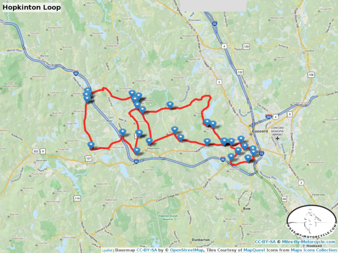
It seems that once I knew enough to start looking for GPX files, and my searches included the term GPX, the subject of mapping and routes with a GPS just started to unfold, easily. Once I understood how the pieces of the GPS puzzle fit together, (so to speak) the Miles-By-Motorcycle mapping function suddenly started working great! (For years, I thought that only Yermo could get it to work;-)

Conclusion:
Learning anything new is a lot like riding a motorcycle. Once youve gotten some traction, and enough momentum to keep from stalling, you just start rolling along. Fear and frustration is replaced by excitement, and then matures to a deep and lasting joy.


You must be a member of this group to post comments.
Please see the top of the page to join.