Miles By Motorcycle
established 11 years ago
A taste of things to come.Subscribe to this blog RSS Feed
    You must be logged in and belong to this group to post to this forum.
    1 of 2
    Yermo
    11 years ago
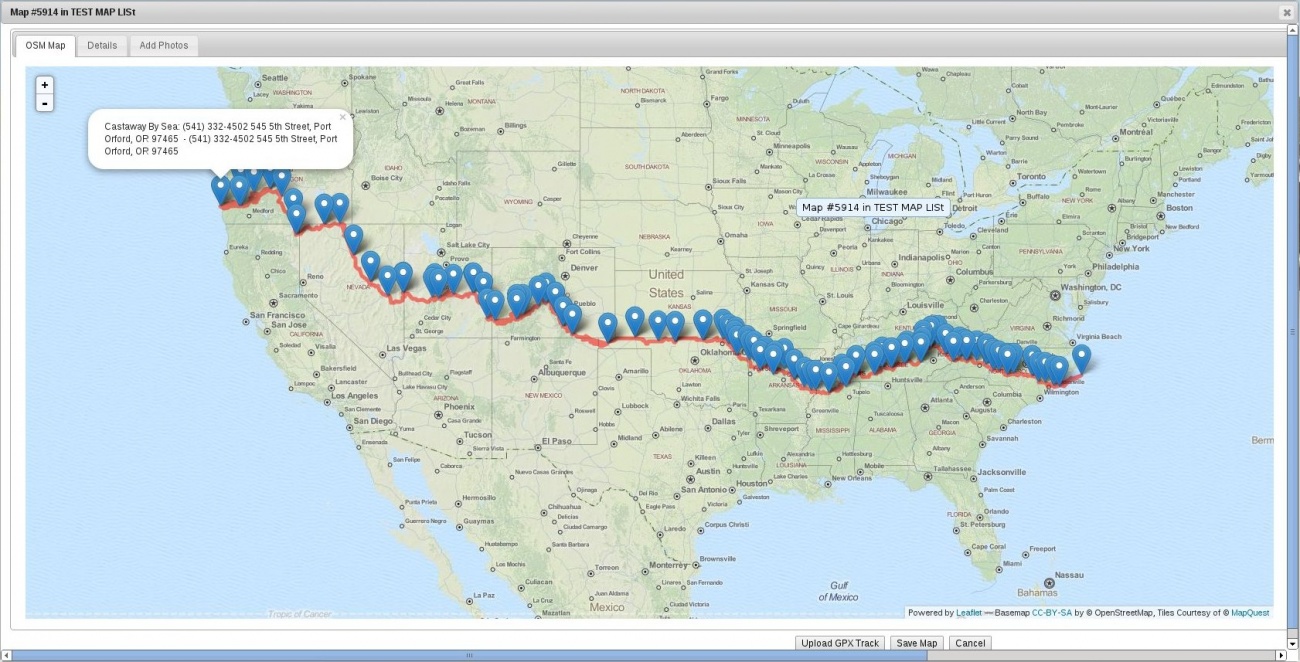
    So to give you an idea what I've been working on, here's a first test of the Maps code. This is an import of a GPS track that rshaug sent me of the entire Trans Am Trail trip. 

    Photo #5646
    Yermo
    11 years ago
    Trans Am Trail - First Map Tests

    Trans Am Trail - First Map Tests

    Here's an early test of the new mapping code.
    What's awesome about this is that it's based on the OpenStreetMap project where all the Geo-spatial data and map tiles are licensed under the Creative Commons license, meaning we can do with the data whatever we want. Google Maps was quite restrictive by comparison. 


    So the idea is once I have this code done that we'll be able to collaborate on these maps right here in the forum together, schedule rides off of them and track the progress of ongoing trips not to mention interact with other riders. It should be pretty cool.
    2 of 2
    Yermo
    11 years ago
    So I posted this screenshot over to the M-BY-MC facebook page.
       
    I get stats on how many people are "reached" by a given post. So far my top post, since I've been keeping track, reached just over 205 people.
    Since yesterday, this map shot has already reached 509 people! Nuts.