
It's too easy to ride past two great Blue Ridge Parkway attractions at Roanoke - Mill Mountain and Roanoke Mountain. Both are just south of the city and worth a visit. The Park Service roads which lead to them are well marked.
Roanoke Mountain & Mill Mountain
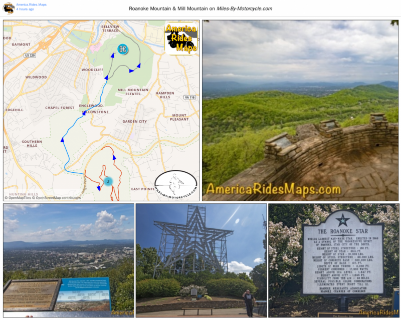
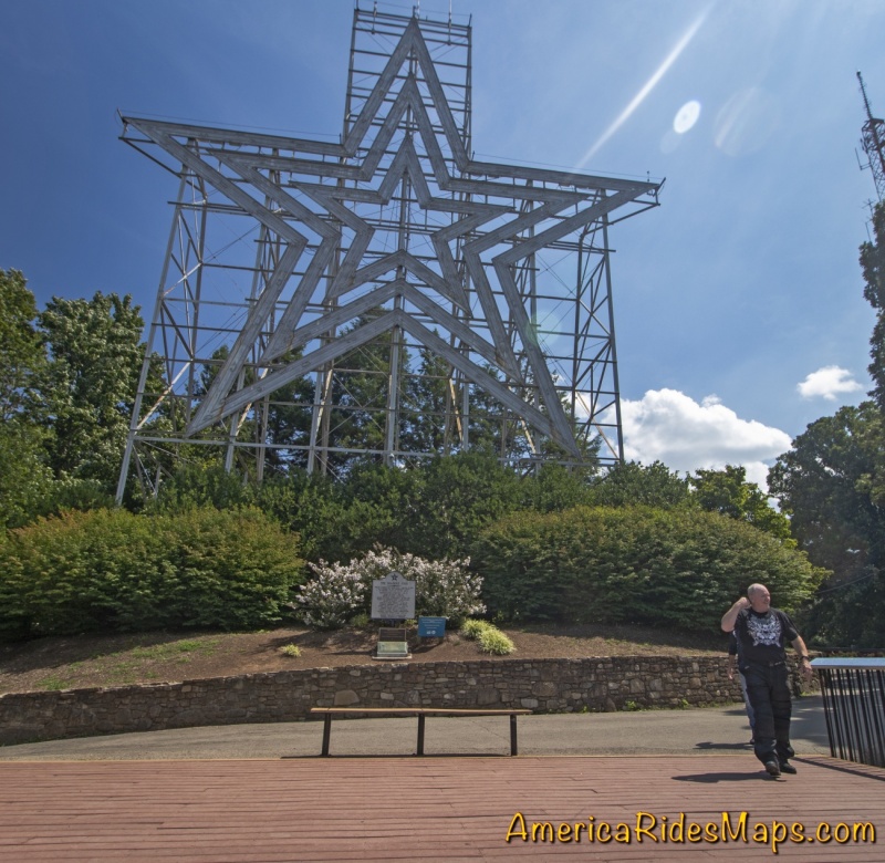
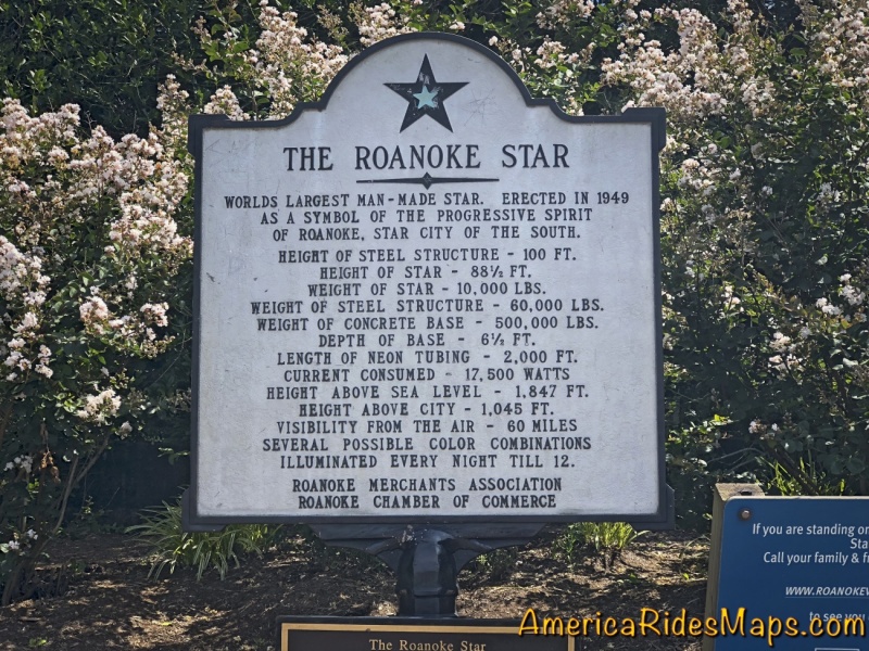
There are two attractions on the Blue Ridge Parkway many travelers miss. Roanoke Mountain has a single lane paved one-way loop road that takes you to a couple nice overlooks. Mill Mountain is home to the Roanoke Star which shines down on the city each night.
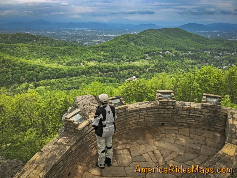
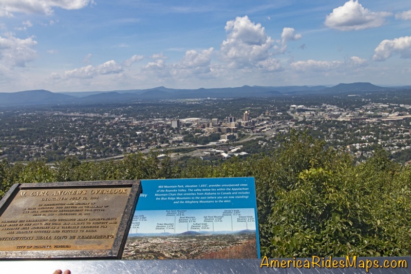
Roanoke Mountain Loop Road at Milepost 120.3 is on the east side of the parkway. The 3.75 mile single lane one-way paved road winds up then down the mountain to reconnect with the Blue Ridge Parkway. There is an overlook at the top of the mountain but the better view is from the Mill Mountain Overlook on the climb up. It takes about 20 minutes to ride it though I always stop at the overlook.
Mill Mountain is home to the famous Roanoke Star which looms above the city. You reach it via the Mill Mountain Parkway at Milepost 120.5. Mill Mountain Parkway is virtually identical to riding the Blue Ridge Parkway, gently curving and climbing to the spur road (Mill Mountain Spur, Prospect Rd SE) that leads to the park at the top. Just walk around the corner from the parking lot and you stand beneath the largest star in the world overlooking the city below.
A zoo, gardens, and visitor center are nearby. It takes about 10 minutes to ride from the parkway to the star. Beyond the spur road, Mill Mountain Parkway becomes JP Fishburn Parkway leading into the city.
Both of these attractions offer better views than you'll find from the parkway as well as a unique experience.
This area is detailed on America Rides Maps Map #2 - The Roads of Roanoke and Beyond
America Rides Maps
Maps of Great Motorcycle Rides in the Blue Ridge Mountains. Blue Ridge Parkway, Tail of the Dragon, hundreds of great biker roads for motorcycle touring. Tennessee, North and South Carolina, Virginia, Georgia motorcycle ride maps,
http://AmericaRidesMaps.com
America Rides Maps makes the most detailed and comprehensive maps of the Blue Ridge Mountains. A series of easy-to-use pocket maps cover the mountains from Virginia to Georgia showing all the best roads and good roads to link them together.
100 Great Motorcycle Rides in the Smoky Mountains | America Rides Maps
100+ Great roads surrounding the Smoky Mountains
https://americaridesmaps.com/produc...
Southeast Blue Ridge Map Package | America Rides Maps
Full Southeast Package, motorcycle maps, motorcycle touring, touring the blue ridge, ride the Blue Ridge Parkway, best motorcycle rides
https://americaridesmaps.com/produc...
Motorcycle Rides surrounding Great Smoky Mountains National Park | America Rides Maps
Motorcycle Rides surrounding Great Smoky Mountains National Park maps, motorcycle smoky mountains, great rides near Great Smoky Mountains, Best motorcycle rides
https://americaridesmaps.com/produc...
3 Map Smoky Park Unpaved Set | America Rides Maps
The unpaved roads in and surrounding Great Smoky Mountains National Park
https://americaridesmaps.com/produc...
#6 The Best Motorcycle Rides Near Smoky Mountains Park - EAST | America Rides Maps
East and south of the Smoky Mountains, the land of the Waterfalls.
https://americaridesmaps.com/produc...
#7 The Best Motorcycle Rides Near Smoky Park - SOUTH | America Rides Maps
South and west of the Smoky Mountains, Waterfalls, The Dragon, and some of the best riding.
https://americaridesmaps.com/produc...
Best Rides NORTH of Smoky Park | America Rides Maps
Rides on the North side of the Smoky Mountains around Gatlinburg, Pigeon Forge, an the surroundings.
https://americaridesmaps.com/produc...
Tags
- 5 americaridesmaps
- 4 north_carolina
- 4 map100smokies
- 3 map6
- 3 scenic
- 3 Map12ClassicRides
- 2 vlogging
- 2 overlook
- 2 historic
- 2 tennessee
- 2 video
- 2 attraction
- 2 MapOR2
- 1 Virginia
- 1 classic
- 1 GoPro
- 1 named
- 1 map2
- 1 MapOR1
- 1 map7
- 1 map8
- 1 mapor1
- 1 Roanoke
- 1 Map100SouthernRides
- 1 Connects_To_Parkway
- 1 Blue_Ridge_Parkway
- 1 view
- 1 map9
- 1 Georgia
- 1 books
- 1 west_virginia
- 1 swag
- 1 store
- 1 Good_Rest_stop
- 1 TN
- 1 coveredbridge
- 1 gopro
- 1 mapOR3


You must be a member of this group to post comments.
Please see the top of the page to join.