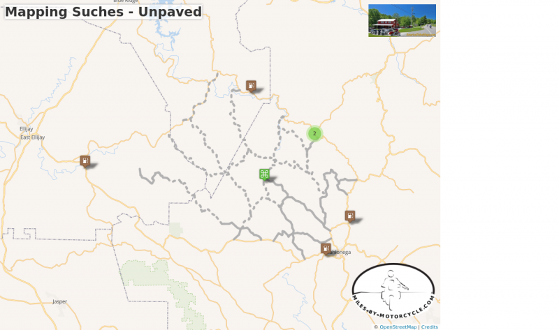
My challenge is mapping a section of unpaved roads in the north Georgia mountains. It's fall, a great time to be in the woods on a motorcycle. I've already done maps of the east, south, and west sides of Great Smoky Mountains National Park. This next map will encompass the unpaved roads in the north Georgia Blue Ridge.
October 7 - Terra Incognita
Large areas of National Forest mean there are a good selection of unpaved forest roads in north Georgia. I chose Suches as the area to map as it is such a popular motorcycling destination due to the superb roads in the surroundings. While I've ridden a few of the gravel roads, there are many more to explore.
It took several days to scan for roads around the small town of Suches, GA. Searching for unpaved roads and trails is challenging. I found some US Forest Service maps online which helped. I did google seaches of the roads for info on whether they were open to motorcycles. I used Google satelite imagery to zoom in on the roads enough to guess if they were paved or not. The resolution is not very high and you'd be surprised how hard it is to tell. It takes a long time to be thorough, but it's worth it to take the time now and eliminate roads which are not accessible. Time is precious when it comes to riding them.
One by one I identified likely unpaved roads, then I located all the paved connecting roads which lead to them and connect them together. I laid all these roads out on a digital map.
Suches is surrounded by potential rides, more than can be done in a day. The largest collections were north and south of GA 60. The south side is more dense and the roads longer, probably more than can be done in a short fall day. It's a good place to start.


You must be a member of this group to post comments.
Please see the top of the page to join.