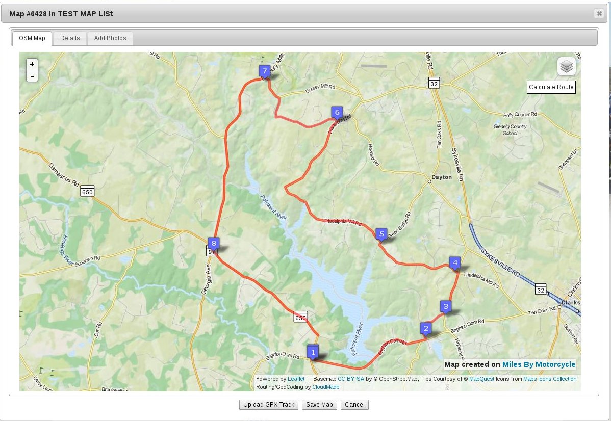
As you've seen with the screen shots, it's coming along rather nicely. I've made quite a bit of progress on adding support for importing data from GPSs and GPS apps. (For those that do not have a dedicated GPS I suggest taking a look at Open GPS Tracker. It can also generate the same kind of GPS tracks the Garmin units can. It might be something for
 rshaug to look at.)
So this is where I'm at:
Upload GPS waypoints from GPX and display on interactive map, done
Upload GPS routes from GPX and display on interactive map, done.
Upload GPS tracks from GPX and display on interactive map, done.
Using the mouse, put user route waypoints on the map, done.
Being able to selectively show/hide any of the above, so you can have the calculated route from the GPS next to the actual track you followed, next to way points and turn any of them on and off. Done.
---------------------------------------------
Stuff I want to get done before maps go live:
---------------------------------------------
Calculate a route between points from above. This will let you plan out of a ride and then connect the dots with a calculated route. In progress now.
Add a "point of interest" on the map using right click and select a type icon (good road, lodging, food, good view, etc), next.
Reverse geocoding of POI points (turn lat/lng to address) to save address along with POI, after that.
Save all of the above in addition to title/description/tags out to database.
Generate a static image of the map and all the routes/points added. (hard)
Create list of maps and POI's page (similar to links page) using the static images from above. Click through the image to get the interactive map.
Add basic searching of waypoints and POI's.
Add downloading of GPX version of map.
Add an Add Map tab to the forum INSERT menu.
Release. ETA, this month.
Then I do some rounds of bug fixing, field the new server and generally improve what we have.
-----------------------------------------------
Things I am planning after release of the maps, not necessarily in order:
-----------------------------------------------
Adding photos to the map with thumbnails viewable on the map.
An address/latlong search feature to make finding a given point easier than having to pan around to find it.
Crossposting to Facebook/twitter/etc.
Geo searching.
Add a Maps tab to the user profiles (actually I need to completely rework on the user profiles).
-----------------
Ride planner:
-----------------
Ride planner which allows you to take a map and turn it into a ride event. Once in ride planning mode you'll be able to add ride event items to the map which will be a combination of meeting points and other items such as :
Invite members - invite members to join the ride. Keep track of the accept/decline/maybe status.
Invite watchers - invite non-riders to lurk on the ride.
add a meeting point - we meet at startbucks at 10AM
add lodging point - we have reservations at Deal's Gap with room for 6. These points would allow people to reserve space and it would keep track of who is going and not allow more than the max people to sign up.
events - for instance we may have a ride that involves a larger event that others who are not on the ride might want to join such as go-cart racing. Will have the same ability to set number of people limits. e.g. 10 people on the boat.
A "guest/suggestion" mode that allows members viewing a map to place a suggestion on the map of a place to go/thing to see and make those suggestions searchable as a separate object type.
---------------------------------------------
Mobile App for Android, Iphone, Windows Phone
---------------------------------------------
Mobile Status Updates/Taggging - (later this summer)
Be able to participate in a scheduled ride.
Optionally broadcast/record location for the other riders.
Mark places on a map where we are intending to head with an ETA so other riders can decide whether or not to join us.
geo-tagged status update as we go on the ride so we can remember cool things we've seen along the way.
Upload photos to the map as the trip progresses.
Indicate intention to meet up at a given meeting point. Broadcasts to all members on the ride.
Be able to show all events that were recorded on a ride on the map as another layer (so we can see what was planned and then what actually happened).
Add searching of ride events so the map in addition to the ride events become a searchable thing.
Much more ....


