Much is broken ... I will have to fix it from the road.

Miles By Motorcycle
established 12 years ago
You must be logged in and belong to this group to post to this forum.
Last minute upgrade of everything I've been working on for the last few years.
Much is broken ... I will have to fix it from the road.
Much is broken ... I will have to fix it from the road.
Slowly I've been making improvements to the site software while I have down time at various points on my TransAmTrail trip.
I still have a lot of work to do to get things such as the maps to render right on phones but it's started to get to the point where the site can, finally, be used on phones.
 buffalo, I wanted to test mentions because I think there's a bug. Please let me know if you get one or two notifications from this message.
The emoticons should work now in the forum so if you like you can in the reply box click the little smiley to get a list of emoticons. If you have any favorites you'd like me to add, please let me know.
The maps are improving. I've got everything set up to generate GPX files from the maps but just have to find some time to write some glue code to put it together. Hopefully in some upcoming break I'll be able to do that.
The Embed button you see in comments and the forum allows you to embed content from elsewhere in the site. For instance, you can embed a map. Click Embed then Search Content. Or you can upload photos directly from the Embed button.
Slowly it comes together.
I still have a lot of work to do to get things such as the maps to render right on phones but it's started to get to the point where the site can, finally, be used on phones.
 buffalo, I wanted to test mentions because I think there's a bug. Please let me know if you get one or two notifications from this message.
 The emoticons should work now in the forum so if you like you can in the reply box click the little smiley to get a list of emoticons. If you have any favorites you'd like me to add, please let me know.
The maps are improving. I've got everything set up to generate GPX files from the maps but just have to find some time to write some glue code to put it together. Hopefully in some upcoming break I'll be able to do that.
The Embed button you see in comments and the forum allows you to embed content from elsewhere in the site. For instance, you can embed a map. Click Embed then Search Content. Or you can upload photos directly from the Embed button.
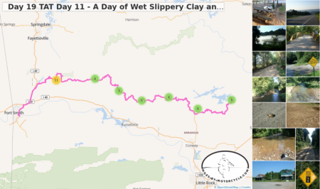
Day 19 TAT Day 11 - A Day of Wet Slippery Clay and Warloop Road, AR.
The day started out very pleasantly but degraded into a wet mess while I was up in the hills. Off camber switchbacks next to steep dropoffs on red clay is very challenging when it's wet. It was very very wet.
Slowly it comes together.

