National Park Maps | NPMaps.com - just free maps, period.
View and download any high resolution national park map: absolutely free PDF and image files of maps from park brochures and handouts, no strings attached.

View and download any high resolution national park map: absolutely free PDF and image files of maps from park brochures and handouts, no strings attached.

A map image overlaid onto a google map with the correct aspect ratio. Pretty cool.

 America.Rides.Maps, yea. I can imagine. After last weekends ADV ride with
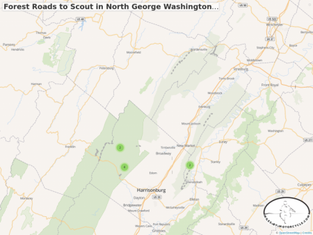
  buffalo and wondering about the legal status of the roads we found, I've been pouring over them comparing what's on OSM. I'm amazed how poorly done the Forest Service map app is. What's interesting is that there are a ton of challenging forest roads starting about 110 miles from my location. buffalo, here's the map of ideas I'm working on for our next ride. Each road listed (zoom in) I've compared against the Forest Service site to make sure it's a legal road. There's a question about FR 374 off Edinburgh Gap Road (675). The site says it's an open road but I could have sworn it's part of the "for-fee" Taskers Gap OHV system. I'll make sure to bring printouts of the PDF maps they provide for additional reference.