
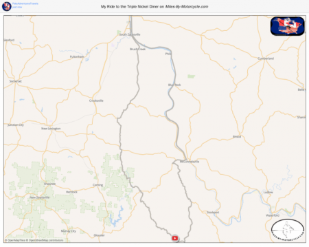
My Ride to the Triple Nickel Diner
This GPX file shows the route I took from Zanesville Ohio to the 555 Diner and back to Zanesville as seen in my YouTube Video.
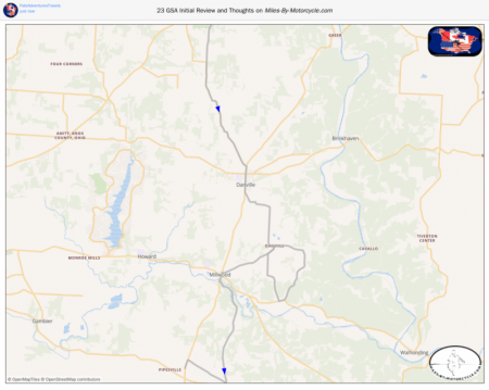
23 GSA Initial Review and Thoughts
The dirt roads you saw in the video. No idea where I really was just making random turns.
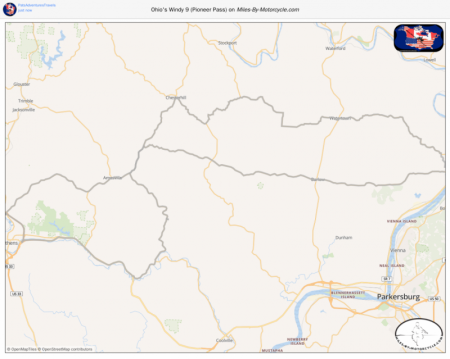
Ohio's Windy 9 (Pioneer Pass)
We ride the Pioneer Pass from Marietta Ohio ending the route in Marietta.
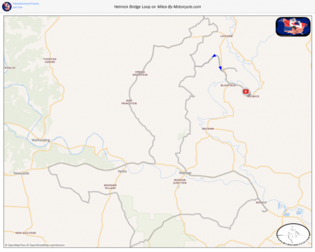
Helmick Bridge Loop
I take about a 60 mile ride starting and stopping at Hemlick Bridge near Killbuck Ohio. A lot of great dirt riding in the area. This is only a small snippet of the great roads!
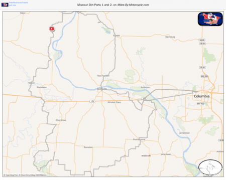
Missouri Dirt Parts 1 and 2.
Here's the route the way I rode it. Noitce the straight line to Columbia. This is because I had turned recording of my route off while I went to the Hotel for the night, but turned it back on in the morning before I reached the place I had stopped the night before. If you want to ride this I would suggest you edit that out before you upload it into which ever decive you're using.
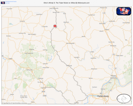
Ohio's Windy 9. The Triple Nickel
I rode this back in September of 2021. I started on the North end of the route and ended up in Athens Ohio. This ride is in conjunction with my YouTube Video on PatsAdventuresTravels.
https://www.youtube.com/PatsAdventuresTravels
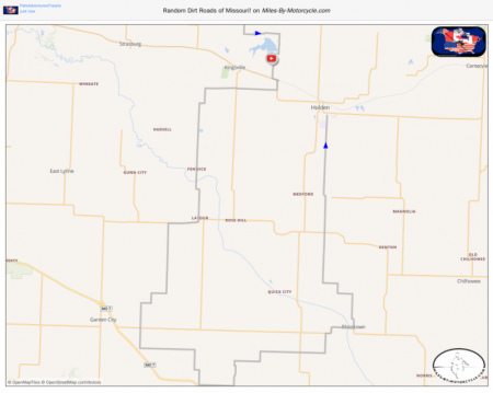
Random Dirt Roads of Missouri!
Just took some random turns on dirt roads in western Missouri. This is a teaser of more gravel of Missouri to come!
https://youtu.be/Eq49T12iSDY
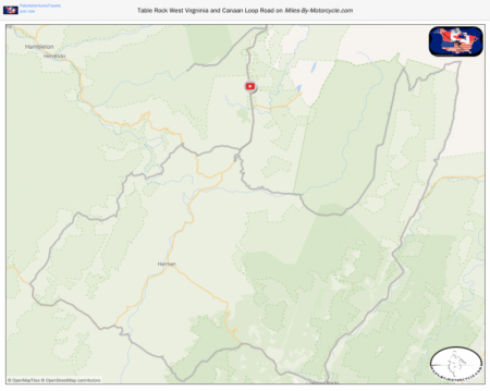
Table Rock West Virgninia and Canaan Loop Road
Here's the map where I go to Table Rock West Virginia and explore the area around Davis West Virginia.
This map coinsides with my video on my channel
https://www.youtube.com/PatsAdventuresTravels
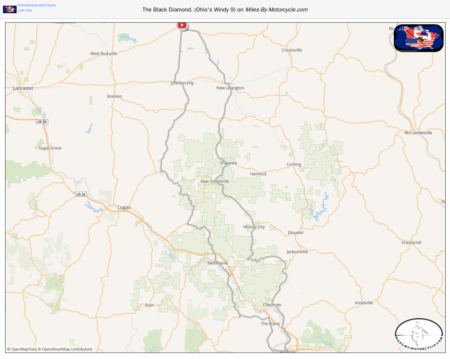
The Black Diamond. (Ohio's Windy 9)
This is a downloadable GPX file that shows the route I took while making the Black Diamond video. This video can be seen on YouTube.
https://youtu.be/J13ArPpfiTc
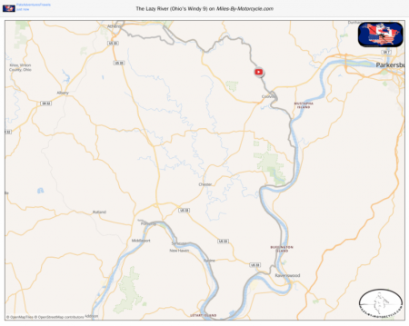
The Lazy River (Ohio's Windy 9)
Here's the Lazy River Ride from Ohio's Windy 9. It is a beautiful ride mostly along State Route 124 paralelling the Ohio River! The town of Pomeroy is simply beautiful, a must see!
This map is in conjuction with my YouTube video.
https://youtu.be/TfliSaerqQ4
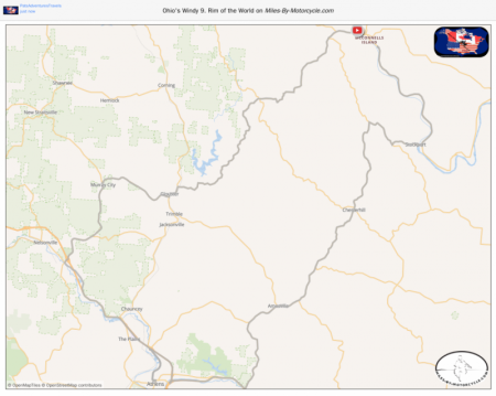
Ohio's Windy 9. Rim of the World
This is part of my Ohio Windy 9 series. Rim of the World. This is the GPX as I rode it including my side trip to Obetty's Red Hots in Athens Ohio, a must stop for food! My route starts and stops in McConnelsville Ohio. This ride is in conjunction with my YouTube Video on PatsAdventuresTravels.
https://www.youtube.com/PatsAdventuresTravels
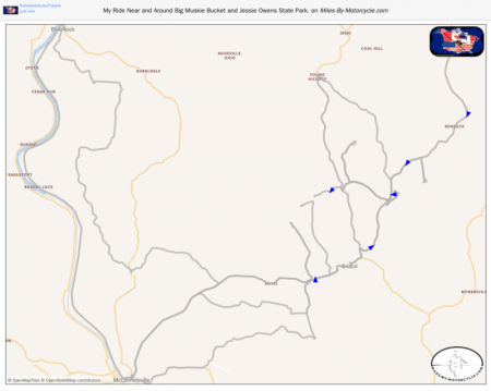
My Ride Near and Around Big Muskie Bucket and Jessie Owens State Park.
I took a day trip to ride some new Gravel Roads near McConnellsville Ohio. I also show the Big Muskie Bucket and the Jessie Owens State Park in this ride. This ride is in conjunction with my YouTube Video on PatsAdventuresTravels.
https://www.youtube.com/PatsAdventuresTravels
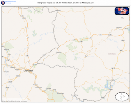
Riding West Virginia and U.S. 60 AKA the Talon.
Took a long day trip to West Virgina to clear some cobwebs out of my head and to test out the new Dunlop Trailmax Mission Tires I just put on. As always these maps are in conjunction with my YouTube Channel PatsAdventuresTravels.
https://www.youtube.com/PatsAdventuresTravels
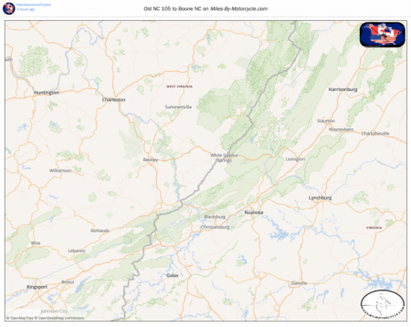
Old NC 105 to Boone NC
Today was mostly just a travel day and I used the Garmin Adventurous Routing on my Zumo XT. I had it one click to the left of full adventure mode. This ride is in conjunction with my YouTube Video on PatsAdventuresTravels.
https://www.youtube.com/PatsAdventuresTravels
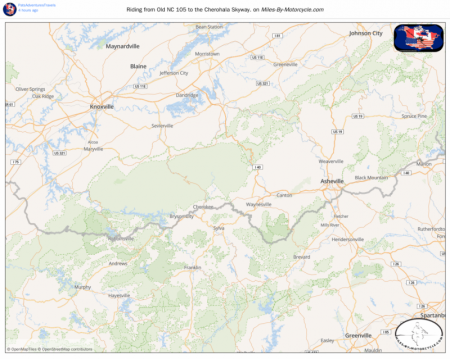
Riding from Old NC 105 to the Cherohala Skyway.
Used Garmin's Adventurous Routing option to take me over to the Cherohala Skyway hoping to find a camp site in the area. This is a mix of pavement and gravel roads. Mostly pavement though.
https://www.youtube.com/PatsAdventuresTravels
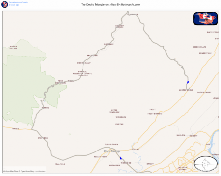
The Devils Triangle
This map shows the Devils Triangle starting and ending in Oak Ridge Tenn.
I did skip the last few miles of Road 330 going back into Oak Ridge. I just continued north for the day.
This map coincides with my YouTube video over at
https://www.youtube.com/PatsAdventuresTravels
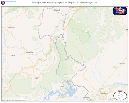
Camping on Old NC 105 and exploring the surrounding area.
This map shows my camp spot on Old NC 105 and all the surrounding roads that I explored over 2 days.
https://www.youtube.com/PatsAdventuresTravels
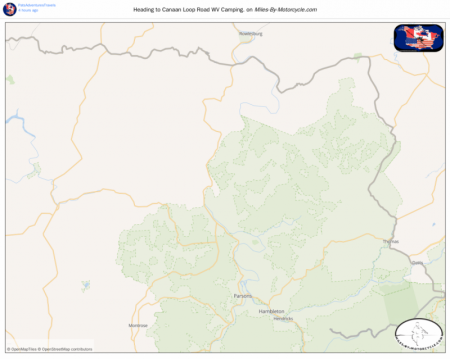
Heading to Canaan Loop Road WV Camping.
This map coincides with my video. It shows the path I took to get to Canaan Loop Road for a 2 night 1 day camping trip I took in September of 2021.
https://www.youtube.com/PatsAdventuresTravels